


LACONIA — During election season, you may have heard of floterial or "float" house districts. Floterial districts exist to increase representation within smaller communities in the Statehouse, and are unique to the Granite State. But what are float districts, and how exactly do they work?
Essentially, floterial districts are multi-town house districts that float over other base House districts that already have at least one representative to the NH House. If a particular base district is just under the population threshold to gain an additional representative, the floterial district can group neighboring, lower population communities that wouldn't normally qualify for another representative to reach the threshold for an additional representative. This grants that base district on the population cusp with an additional representative, while simultaneously creating another representative for those smaller communities.
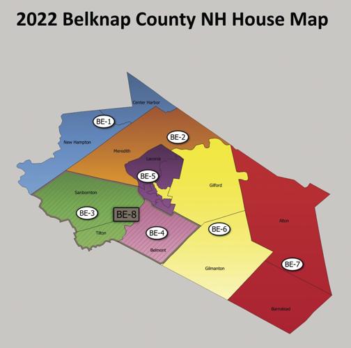
“For example, you have Belmont right on the corner of the county, it has well over the number of people it needs for its own district,” explained Brian Beihl, former deputy director of Open Democracy, a nonpartisan nonprofit with a focus on fair redistricting. “They have one district devoted to Belmont, and it's part of the floterial with Sanbornton and Tilton because they have to be able to account for the residual population."
The required population for one House seat in New Hampshire is 3,444, plus or minus 5%. That number is determined by the U.S. Census count, which is updated every 10 years.
“If you have 3,444 times two, plus 1,000 extra people, then you have to do something with that extra 1,000 people,” Beihl said. “That's where floats come in.”
To understand float districts, the first step is understanding base districts. Any community that falls within the magic number of 3,444, plus the 5% deviation, is considered a base district. When smaller communities are joined together for base districts, a float district can be created to help represent those smaller groups, explained Liz Tentarelli, president of the New Hampshire League of Women Voters.
“The problem is that according to the Constitution, as of 2006, a town of 5,500 is large enough to have its own base district, and then those people who are part of that district get represented by being part of a floterial that might cover two, three, four or five towns, towns, picking up those extra voters. And so the person in Town A of 5,500 is in two districts,” Tentarelli explained. “His base, and his floterial. And he gets to vote for both of those districts, and the person in Town B also has his own base district — we'll call it District 2 — is part of this floterial that has a higher number in the naming convention, let's call it District 25.”
In short, the person in Town A votes for their local representative, then the person in Town B votes for their own representative. Both voters would then also vote for the representative of the float district.
“It's complicated and very difficult to explain,” Beihl said. “It’s challenging. Then you add gerrymandering on top of that, so it’s difficult.”
Due to the rules surrounding House districts, it's very difficult to create maps that provide perfect, or even equal representation.
“A base district can't cross county lines because of the county responsibilities representatives have,” Tentarelli said. “Add that to the fact we have 400 seats divided by a population of 1.4 million, that's where we get this 3,444, and 5% doesn't give you a lot of wiggle room.”
Although float districts can be a way for smaller communities to gain representation they otherwise wouldn't have, as well as bolster those towns that are on the cusp of additional representation, Tentarelli says they may be prone to gerrymandering, and their scale can reach sizes that still result in reduced representation.
“Some [floterial districts] are huge. There was a floterial that covered 10,000 people. It was Manchester-Litchfield" in the previous redistricting, Tentarelli said. “In 2011 they created that, and the representative from that said, 'How is this logical that I'm now representing 10,700 people?'”
“I was in the Monadnock region, Hillsborough District 38, which covered from Windsor all the way to Wilton, which was a distance of 20 miles, this long-snaking House district,” Beihl said. "Here’s where the constitutionality comes in. Remember that magic number of 3,444 per representative? How you got a rep who is ostensibly a rep if you add up nine towns in, ... it came to be 15,000 or 20,000 people, so you have a rep that is representing 20,000 people. And it creates a situation where those people are under-represented.”
After the 2020 U.S. Census, two groups went to work on redistricting the Granite State. The first, and ultimate authority, was the state Legislature. The second was Open Democracy, which ran the Mapathon initiative in order to create a more accurate and constitutionally compliant map for voters.
“We created our own [maps], which in our view were better because we allowed for more towns to have their own districts,” said Mapathon contributor David Andrews. Andrews studied electrical engineering at the University of New Hampshire and worked as a test engineer for several years before transitioning to the field of data science. Andrews had mathematics, not politics, guiding his map-making efforts.
“A lot of people testified and said they'd rather have the Mapathon maps than the ones presented by the Legislature,” Andrews said. “The Legislature maps have 55 towns that are eligible and don't get their own base. We got that down to 40. So 14 more towns were able to get their own base under our maps.”
Due to the mathematics involved, the 2006 constitutional amendment requiring representatives for such specific numbers and the restrictions of keeping base districts all within the same county, it's been a challenge to draw a map completely free of constitutional violations.
Despite the lower rate of constitutional violations found in Mapathon's maps, the Legislature rejected the renderings, and went with their own map.
In response, the city of Dover along with other communities and voters filed a lawsuit against the secretary of state earlier this year.
“It started with the city of Dover, whose Ward 3 was not given its own district,” Andrews recalled.
The city of Dover's attorney Joshua Wyatt shared a copy of the initial complaint, which lists the cities of Dover and Rochester, and 10 voters from six other communities.
The suit challenges the 2020 redistricting as unconstitutional and “plaintiffs also seek permanent injunctive relief either requiring the state to create and institute a district map to address the constitutional violations stated herein, or implementing the Court's own map as a permanent remedy.”
The case is still in active litigation in Strafford County superior court.
Floterial districts also make drawing district maps difficult. The Secretary of State’s Office has no statewide House district map, due the difficulty of drawing floterial districts.
As for making more accurate maps, it's not likely the state will see changes until the 2030 U.S. Census, unless litigation such as Dover's suit makes it to the New Hampshire Supreme Court.
“There's very little chance anything will change because it would take a court action, and I don't think it’s going to happen with the makeup of the NH Supreme Court,” Beihl said.
Editor's note: This story was updated to clarify Brian Beihl's former role with Open Democracy.


(0) comments
Welcome to the discussion.
Log In
Keep it Clean. Please avoid obscene, vulgar, lewd, racist or sexually-oriented language.
PLEASE TURN OFF YOUR CAPS LOCK.
Don't Threaten. Threats of harming another person will not be tolerated.
Be Truthful. Don't knowingly lie about anyone or anything.
Be Nice. No racism, sexism or any sort of -ism that is degrading to another person.
Be Proactive. Use the 'Report' link on each comment to let us know of abusive posts.
Share with Us. We'd love to hear eyewitness accounts, the history behind an article.