


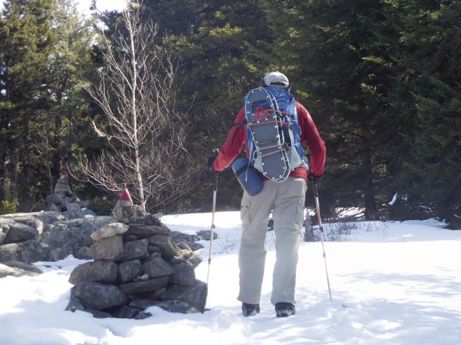
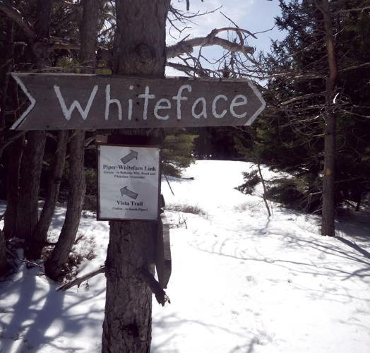
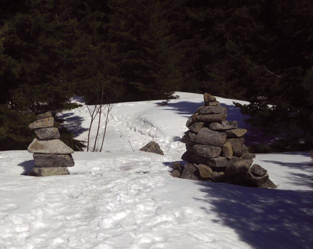
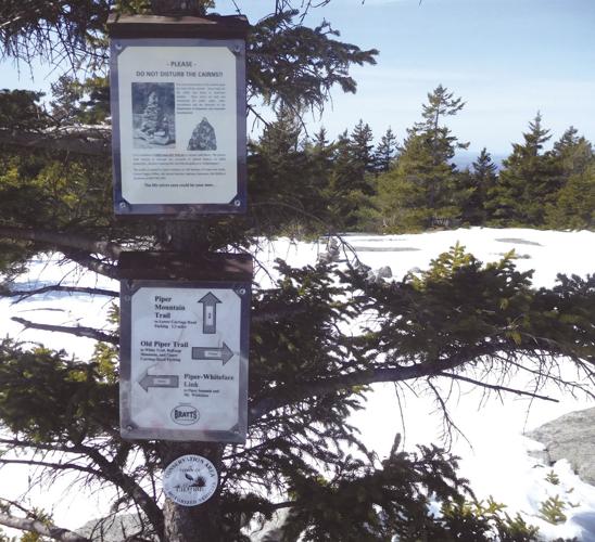
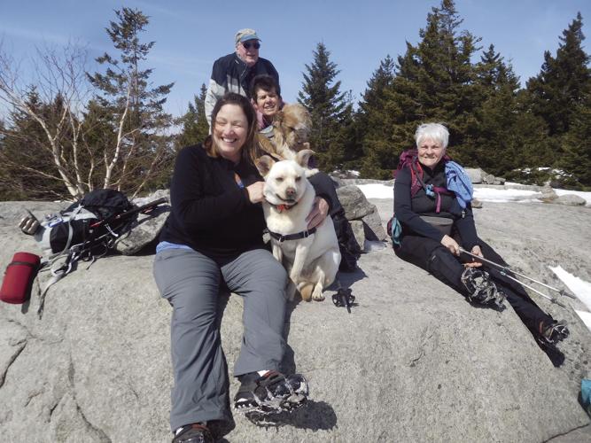
I wove my way along a well-established trail on the side of Gunstock Mountain, reading the snowshoe tracks ahead of me and following brightly colored blue blazes painted on trees. I arrived at an intersection of three trails. I wondered which one to take on my journey to the summit of Belknap Mountain. I suddenly spied a trail sign for the Belknap Mountain Fire Tower. I plodded ahead, continuing to follow the blazes and signs, leading me to the summit. I continued over the mountain, making my way to Piper Mountain and onto Whiteface Mountain. By following the well-marked trails, watching for blazes, cairns, and signs, I easily completed my full-day trek in the southern Belknap Range.
This is not an easy task in winter, because signs, blazes, and cairns are often covered in snow. However, my successful trek was made possible by the work of the Belknap Range Trail Tenders, better known as BRATTS. This group of dedicated volunteers has worked endlessly to provide well-marked and safe trails throughout the Belknap Range; trails that are signed, well-blazed, brushed, cleared of blowdowns, and marked with cairns in key locations.
My experience is common among the many people who venture into this mountain range from all over New England. We are thankful for the work of BRATTS.
Several years ago, I attempted to hike from Mount Mack to Mount Anna. I was foiled in my attempt by poor signs, no blazing, and several blowdowns across what appeared to be the trail. I had to turn back before reaching Mount Anna.
A few weeks later, I learned about BRATTS and decided to attend an organizational meeting at the Gilford Library. Within a few moments, I was hooked by the enthusiasm and commitment by a few people who were dedicated to building and maintaining trails in the Belknap Mountains.
I decided at that point to become a trail adopter with my friend Steve. We adopted the Round Pond-Piper Link Trail and, over five years, devoted many hours to clearing, brushing, and blazing a trail that had fallen into disuse. We even built a bypass trail to avoid a steep and dangerous section of the trail. During that time, I got to know many committed people who freely give their time and energy to make the trail system a safe and enjoyable experience.
BRATTS was formed in 1997 by a small group of volunteers, led by Hal Graham. In 2012, it was formally organized as a nonprofit in the state of New Hampshire. BRATTS is “an independent hiking trail maintenance organization: aspects to include the continuation of trail crews and an adopt-a-trail program utilizing Best Management Practices for protection of the environment. To foster and develop relations with organizations, and landowners — private and public — that include trails on their lands in The Belknap Range.” (BRATTS Mission Statement).
The organization relies totally on volunteers to do trail work so that individuals, groups, and families can enjoy hiking in this beautiful, small mountain range. It is a typical grassroots, community-based organization that relies on a small, dedicated group of people to achieve its mission, and is symbolic of the famous quote by Margaret Mead: “Never doubt that a small group of thoughtful, committed citizens can change the world; indeed, it's the only thing that ever has.”
BRATTS interfaces with many other organizations that have ownership of much of the land in the mountain range, such the Daniel Webster Boy Scout Council, the Society for the Protection of New Hampshire Forests, the State of New Hampshire, Lakes Region Conservation Trust, private landowners, and Belknap County. All trail work is done under the supervision of the New Hampshire Division of Forest and Lands and the Gunstock Area.
At present, there are 21 trails covering 45 miles, and all of the trails have adopters whose job is to maintain the trails for public use. Volunteers of all ages, backgrounds, gender, and skills work together to continue the work started many years ago by Dave Roberts.
Dave, who died in 2017 at the age of 82, cut and blazed many of the trails in the Belknap Range in the 1980s and '90s. He was also instrumental in helping the Society for the Protection of New Hampshire Forests acquire a 70-acre tract of land near the Mount Major trailhead. Dave created the first trail maps of the Belknap Range, which included features like waterfalls, gorges, boulder caves, a granite quarry, a charcoal kiln from the 1800s, viewpoints, an iron mine, and farms.
Hal Graham, the founder of BRATTS, met Dave in the year 2000 and Dave shared with Hal some of the maps he was working on. They continued to meet in the Belknap Mountain fire tower, sharing maps and their vision for a trail, following the spine of the range from Mount Major to Belknap Mountain. This is now the Belknap Range Trail or BRT. The idea of a network of connecting trails in the Belknap Range was born in the Belknap Mountain fire tower and now we have more than 45 miles of marked and maintained trails, thanks to Dave and Hal and their pioneering work.
Dave’s maps form the basis of the Belknap Range Trail Map and are available online at www.belknaprange.org or for purchase at the Gilford, Gilmanton, Laconia, and Alton libraries, for a small fee.
In 2018, 33 volunteers devoted 1,457 hours to trail maintenance and major trail work, which included building a rock crib on the Locks Hill Trail; trail improvements on the Piper Mountain Trail and the Benjamin Weeks Trail; on Gunstock Mountain, the Ridge and Brook Trails; and cut new re-routes on the Upper Brook Trail and the East Gilford Trail, making the upper section of the trail safer.
Trails projects for this year include, on Gunstock Mountain, continuing the reconstruction of the Gunstock Ridge Trail and Brook Trail; on Belknap Mountain, continuing reconstruction and repair of the Blue and East Gilford Trails; and on Locks Hill, installing water bars and drainage on the Quarry Ridge Trail.
If you are interested in learning more about BRATTS, visit www.bratts.org or, better yet, make plans to attend their annual meeting on Wednesday, April 10, at 6 p.m. at the Gilford Library. The board of directors would like to hear your ideas, suggestions, and comments. If you’re interested in becoming a trail adopter, then show up and I’m sure there is a trail waiting for your adoption.
For those of you who have never walked or hiked any of the trails in the Belknap Range, you should plan to take to the woods and mountains of the Belknap Range. With spring emerging from winter’s long hold, now is an ideal time to hike on one of the 27 trails maintained by BRATTS. One of my favorites starts at the end of Bickford Road, off Route 11A. Park your car in the established parking lot, walk around the gate, staying on the established fire road. The dirt road will then join the red trail. Within a mile, it will junction with the green-blazed Round Pond-Piper Link Trail. That trail will lead to a beautiful mountain pond — Round Pond — following a new route with impressive stone work. At the end of the pond is a campsite and picnic area. If you feel motivated for a mountain climb with views of the Belknap Mountains and Lake Winnipesaukee, you can continue, following red blazes over Mount Mack and Mount Klem. Be sure to download the Belknap Range Trail map at www.Belknaprangetrails.org.
And don’t forget Microspikes and/or snowshoes. There is still plenty of snow and ice on the trails and in the woods.
Happy hiking, and I hope to see you at the April 10 BRATTS annual meeting.


(0) comments
Welcome to the discussion.
Log In
Keep it Clean. Please avoid obscene, vulgar, lewd, racist or sexually-oriented language.
PLEASE TURN OFF YOUR CAPS LOCK.
Don't Threaten. Threats of harming another person will not be tolerated.
Be Truthful. Don't knowingly lie about anyone or anything.
Be Nice. No racism, sexism or any sort of -ism that is degrading to another person.
Be Proactive. Use the 'Report' link on each comment to let us know of abusive posts.
Share with Us. We'd love to hear eyewitness accounts, the history behind an article.