


The Sandwich Mountain Range extends 30 miles from east to west across the beltline of New Hampshire. There are seven four thousand foot peaks in the range, along with seven others just under the 4,000 foot bar, one of those being Mount Paugus at 3,198 feet, the dwarf of the Range. However, Mount Paugus can hold its own with regard to the views and its challenging trails. It is also the only mountain summit that must be reached by bushwhacking through scrappy spruce and undergrowth. Many people assume they have topped the highpoint when they reach the nob near the summit, and have been disappointed to learn from others that they failed to reach the recognized highpoint. They must then reluctantly tramp up the mountain a second time to claim the rights to summiting Paugus, recognized atsone of the highest 200 peaks in New Hampshire, and for peak baggers that’s an important accomplishment.
Paugus Mountain was once called Old Shag, due to the many ledges surrounding its peak. It was named by Lucy Larcom, a teacher, author and poet who spent summers in the Tamworth and Ossipee Area. Larcom named the mountain in honor of the great Indian chief of the Sokosis Tribe, who was killed in 1725 during a raid by Capt. John Lovewell near what is now Freyburg, Maine. Larcom’s poetry caught the attention of John Greenleaf Whittier, who was also a summer traveler in central New Hampshire. Larcom and Little Larcom Mountains, located in the Ossipee Mountain Range, are named in her honor. Mount Whittier situated east of Larcom Mountain is named in honor of Larcom’s close friend.
The Sandwich Mountain Range and the town of Sandwich were named by Provincial Governor Benning Wentworth in honor of John Montagu, fourth Earl of Sandwich, an influential friend of King George II and III. At that time the mountain range was considered inaccessible and uninhabitable. It wasn’t until 1869 that Charles Vose, under the guidance of NH State Geologist Charles H. Hitchcock, began to survey and map the Sandwich range. By the 1890s the trails began to take shape, led by the diminutive Katherine Sleeper. She’s described as, “Small blond, with deep blue eyes, a high pitched voice and a veritable dynamo.” She was the mastermind behind the formation of the Wonalancet Out Door Club and led the charge to preserve the core of the Sandwich Range from the depredations of loggers. She also organized trail crews to cut paths through the range and to several prominent peaks including Mounts Chocorua, Whiteface, Passaconaway and Paugus. Kate Sleeper’s legacy is firmly entrenched in the Wonalancet region and the Sandwich Mountain Range: If you have climbed Mounts Katherine, East or West Sleeper, explored the White Face Natural Bowl or hiked along Sleeper Ridge and the Sleeper Trail you are indebted to Katherine Sleeper.
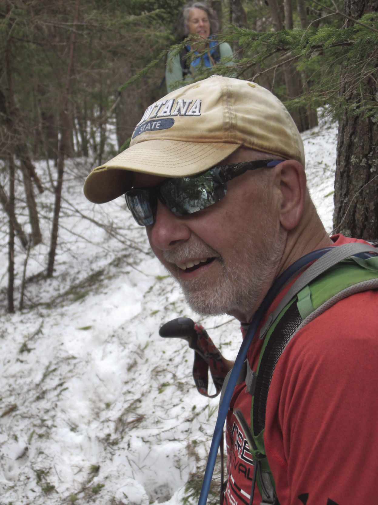
Earlier in the spring, with snow still clinging to the mountainsides, I was joined by Barbara, Susan and Dave for what I thought would be an easy ramble to the summit of Mount Paugus by way of the Cabin Trail and returning on the Big Rock Cave Trail, WRONG! The snow cover above 2,800 feet was significant and we did a lot of wading through two feet of wet snow, sinking up to our knees. I lost my camera on one plunge into a spruce trap, but luckily found it after I discovered it missing. I had to hike back a quarter mile to find it laying where I had fallen earlier. Hiking friends have reported that there is still significant snow levels about 3,000 feet.
We planned to do a circuitous route hiking to Mount Paugus on the Cabin Trail, joining the Lawrence Trail, and climbing up the ledges near the true summit. Then return to Route 113 by way of the Big Rock Cave Trail. This route would afford us outstanding views of the eastern end of the Sandwich Range.
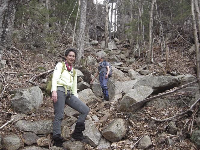
We parked our vehicles at a small parking area off Route 113A across from the trailhead. The trail took us on a gradual climb on an old logging road and then along Whitin Ridge. We slabbed lengthwise, carefully picking our route due to the ice and snow that still covered the trail. The views of the cliffs and ledges along the ridge were spectacular, especially since the trees were still naked.
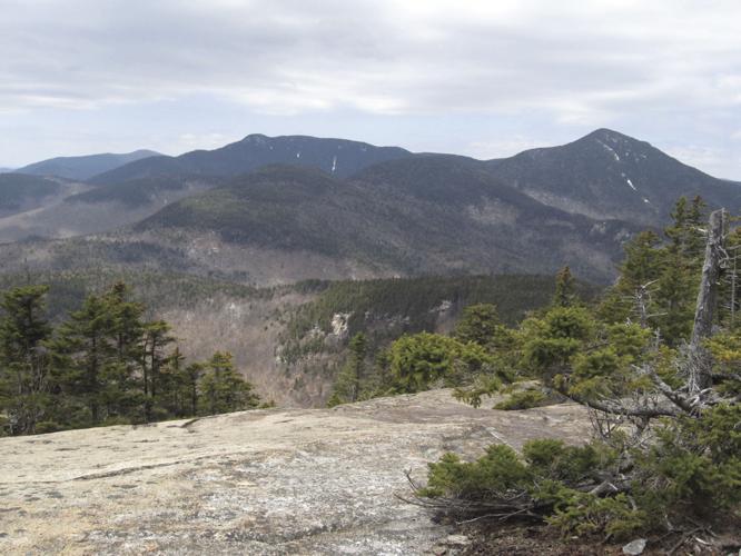
Once on the Lawrence Trail we began the scramble, ascending the steep slope by switchbacks to the open South Ledges ,not far from the true summit, which is a few hundred yards off the trail. Once on top we lounged for an hour, chatting and admiring the views from a number of different rock outcrops. I followed a herd path to another set of open ledges with magnificent views of Mounts Whiteface and Passaconaway, along with the deep glacial bowl or cirque below me. Even though Paugus is the runt of the litter in the Sandwich Range, the views are unmatched with the exception of Mount Chocorua.
After our extended stay for lunch and conversation we began our descent, wading through wet snow and hidden flows of snow melt, following the Lawrence Trail to the Old Paugus Trail. Once through the snow fields we were able to make good time, following the Old Paugus Trail along a shoulder with many downed trees that resembled a pile of pick-up-sticks, most likely the aftermath of Hurricane Irene or other storms that have raked the mountains. The trail through this maze of rubble is a testament to the work of the Wonalancet Out Door Club’s trail crew.
The next hurdle was crossing Whitin Brook, swollen by snow melt and spring rains. The crossing proved to be a challenge in finding a safe place to cross. Susan and I gave up and simply waded across carefully planting our feet, but soaking our feet and legs. While at the same time Dave searched along the bank, trying to find the safest rocks for leaping across the stream, which he did. Barbara on the other hand, after a considerable exploration, took off her shoes and socks and waded through the ice cold water, making it safely across.
After the stream crossing we “hit” the junction with the Big Rock Cave Trail and began our final two mile push to the finish line. We sauntered over the flat ridge of Mount Mexico and on to Big Rock Cave. This so-called cave is made up of a jumble of giant slabs of rocks, some larger than a good size house. This natural rock pile, with tunnels to explore, should not be missed. Children, as well as adults, will find excitement exploring the tunnels and climbing rock slabs that are heaped on top of each other. The caves were created by the last glacier while it retreated north, carrying with it debris and dumping it along its path as it made its retreat northward. The Big Rock Caves are worth a hike by themselves and are only one mile from the trailhead on Route 113A.
This hike proved to be a challenging adventure given the time of year, when the trails were inviting, but at the same time higher elevations were loaded with snow. Thankfully summer temperatures have taken hold and most of the snow has melted, but there still may be patches of it in shaded areas and cols. Having recently hiked the West Brook Trail in Chatham, NH I can attest to the fact that snows have disappeared from most trails, but have been replaced with hordes of flying insects, desiring blood. If you do take to any trail this time of year bring plenty of bug dope. Have fun and stay safe, remaining six feet apart from your hiking partners.
If you would like to learn of other family hikes to New Hampshire’s special places, consider purchasing Gordon’s book, Paths Less Travelled, at Innisfree Bookstore in Meredith, Gibson’s Bookstore in Concord or The Mountain Wanderer Bookstore in Lincoln.
•••
For questions or comments contact Gordon at foretpd@metrocast.net


(0) comments
Welcome to the discussion.
Log In
Keep it Clean. Please avoid obscene, vulgar, lewd, racist or sexually-oriented language.
PLEASE TURN OFF YOUR CAPS LOCK.
Don't Threaten. Threats of harming another person will not be tolerated.
Be Truthful. Don't knowingly lie about anyone or anything.
Be Nice. No racism, sexism or any sort of -ism that is degrading to another person.
Be Proactive. Use the 'Report' link on each comment to let us know of abusive posts.
Share with Us. We'd love to hear eyewitness accounts, the history behind an article.