


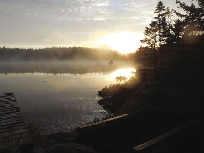
When Fran and I awoke in the morning the sun was rising over Russell Pond, breaking through the thick cloud cover that had plagued us the past two days. We hoped the new day would bring us bright skies and a relief from the fog, mist, and rain.
The morning sun reflected off the tranquil waters, creating a brilliant array of colors in the forest surrounding us. When we arrived at Russel Pond the previous afternoon, we considered ending our plan to hike to Matagamon Gate (the northern gate of Baxter State Park) and continue on to Katahdin Woods and Waters National Monument. We trudged into the Russell Pond Campsite the previous day soaked to the bone. Every stitch of clothing, even our feet, was soggy from the drenching rain that accompanied us as we climbed over Hamlin Peak (4,756 feet) and along the North Peaks Trail. Now, with the sun emerging from the shroud of clouds above, our hope to complete the 71-mile journey was reignited. With confidence, we decided to push on to South Branch Pond Campground, continuing our trek to the Northern Gate of Baxter and into the Katahdin Woods and Waters National Monument (KW&WNM). A Beatles song leapt out of my memory, “Good day sunshine"
"Good day sunshine, Good day sunshine. We take a walk, the sun is shining down, Burns my feet as they touch the ground”.
In 1930 Percival Baxter, Maine's governor from 1921 to 1924, purchased 6,000 acres of land in northern Maine, including Baxter Peak at 5,267 feet, Maine’s highest peak. In 1931 Baxter deeded the parcel to the State of Maine with the condition it remain forever wild. Over the years he continued to purchase tracks of land, adding to the park’s size and scope. Today Baxter State Park (BSP) encompasses 209,644 acres, some of which is the most magnificent wilderness in the eastern United States. Governor Baxter stated, “Man is born to die, his works are short-lived. Buildings crumble, monuments decay, wealth vanishes. But Katahdin in all its glory, forever shall remain the mountain of the people of Maine.”
I had planned this 71-mile backpack trip earlier in the year. My intention was to hike from Roaring Brook Campground, over the Katahdin massif, to the northern gate of the BSP and then trek south through the newly designated Katahdin Woods and Waters National Monument, which lies on the eastern border of BSP. In 1991 Roxanne Quimby,, co-founder of the Burt’s Bees, Personal Care Products, began purchasing land in the vicinity of BSP with the intention of creating a national park. Due to political squabbling she abandoned this vision and turned her attention to creating a National Monument by way of the Antiquities Act of 1906. The 87,563-acre Monument was established by a proclamation of President Obama on August 23, 2016. It is interesting to note that the Antiquities Act was signed into law in 1906 by President Theodore Roosevelt, who spent his early years while at Harvard, hunting, fishing and hiking in the area of this newly created National Monument. I think TR would be very pleased to know that the land has been set aside.
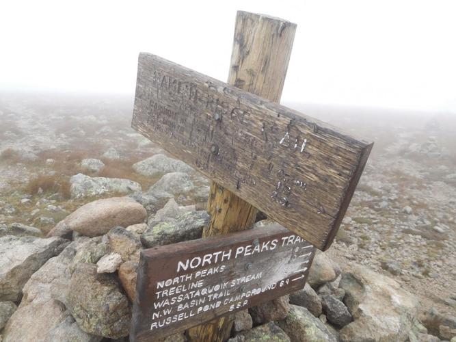
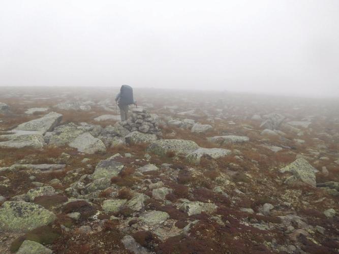
Two days prior to our stay at Russell Pond we left Fran’s truck at the home of our shuttle driver, Lloyd, who drove us into BSP and left us off at Roaring Brook Campground. From Roaring Brook we hiked four miles to Chimney Pond Campsites at the base of Mount Katahdin, where we spent our first night. The clouds and rain had moved into the area that day and by evening a thick pall of fog and mist enveloped our cabin. The next day we hitched up our packs and began the climb to Hamlin Peak via the rugged Hamlin Ridge Trail. The trial climbs a steep ridge to the summit. Fran and I expected views of the South Basin, Baxter Peak, South Peak and Pamola, but we only peered onto gray fog. When we reached the summit of Hamlin we began a long, arduous hike through the open northern tablelands, following North (Howe) Peaks Trail, which traverses the rim of the headwall of North Basin. The mist, rain and fog continued, making the boulders slippery and dangerous. Fortunately the trail was well marked with cairns, making our trek manageable in the thick fog enshrouding the ridge. As we descended off Howe Peak we were overjoyed to reach tree line, ending our harrowing trudge through what seemed like endless rocky knobs and fields of boulders. When we checked into the Russell Pond Campgrounds we were elated when the park ranger said we could sleep in the Bunk House, a small cabin with a wood stove. Hallelujah, we could get warm, dry our clothes and sleep in moderate comfort. The following day, under clearing skies, we began our trek along the Pogy Notch Trail, making our way to the next destination, South Branch Campground.
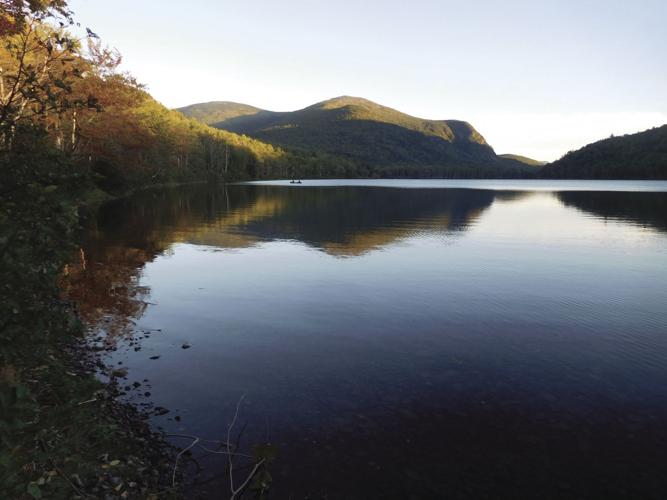
The Campground is located at the eastern end of Lower (northern) South Branch Pond and is accessible by car from the north gate of the park. The Maine Mountain Guide states, “The South Branch Ponds have perhaps the most spectacular surroundings of any in Maine, except those near Katahdin." The pond lies in a deep valley between Traveler Mountain Ridge (North Peak, 3,152 feet and The Traveler, 3,541 feet) to the east and Black Cat Mountain (2,630 feet) and South Branch Mountain (2,611 feet) to the west. After arriving at the campground we set up our tent and began to make plans to climb the Travelers the following day. However, due to our exhausted physical state from hiking the last three days through rugged back country, we decided to limit our escapade and climb only North Traveler, not the entire Traveler Loop Trail. The ten-mile loop is a strenuous and long hike with extended exposure above tree line, climbing the summits of three mountains: The Traveler, Peak of the Ridges, and North Traveler. The total elevation gain of 3,700 feet is only 400 feet less than required of a Katahdin hike on the Hunt Trail, the most demanding hike in the park.
Under bluebird skies, Fran and I hiked to the N. Traveler summit (2.5 miles). The trail follows the crest of the North Traveler ridgeline, through lovely alpine meadows and over rock ledges. The views from the ridge were overwhelming. We peered down into the South Branch Ponds, over to Traveler, Black Cat and South Branch Mountains. In the distance we viewed the Katahdin massif and the expansive Maine wilderness to the north and east.
Starting early the next day we followed the Middle Fowler Trail, past pristine Fowler and Middle Fowler Ponds. A side trail led us to the summit of Barrel Ridge Mountain, with outstanding views of Grand Lake Matagamon, Bald Mountain and lands to the west and north. The trail took us through old growth forests, beautiful woodland meadows and wetlands. We soon reached Trout Brook Farm Campgrounds, and spent our last evening in BSP, tenting near the ranger station. Fran and I looked forward with great anticipation to hiking out of the park the next day and camping at Matagamon Wilderness Campgrounds. It’s a private campground, located a short distance from the park entrance on the East Branch of the Penobscot River. Arriving early the next day we had a chance to shower, consume burgers, beer and pizza at Mama Bear's Kitchen before we began the second half of our journey, hiking south into the Monument (as the locals call it with some distain, as it’s off limits for hunting and motorized vehicles).
When we were preparing to begin our 5-day trek through the National Monument, we noticed a small dog wandering around our campsite, inquisitively looking for companionship. Little did we know that this beautiful canine, Little Boy, would accompany us, leading the way through the wilderness. To learn more about Little Boy and his fate, as well as the adventures of Fran and Gordon in the Katahdin Woods and Waters National Monument, stay tuned. Part Two of this essay will appear in next Friday’s edition of the Laconia Daily Sun.
For questions or comments you can contact Gordon at forestpd@metrocast.net


(0) comments
Welcome to the discussion.
Log In
Keep it Clean. Please avoid obscene, vulgar, lewd, racist or sexually-oriented language.
PLEASE TURN OFF YOUR CAPS LOCK.
Don't Threaten. Threats of harming another person will not be tolerated.
Be Truthful. Don't knowingly lie about anyone or anything.
Be Nice. No racism, sexism or any sort of -ism that is degrading to another person.
Be Proactive. Use the 'Report' link on each comment to let us know of abusive posts.
Share with Us. We'd love to hear eyewitness accounts, the history behind an article.