


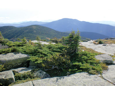
Looking west from summit of East Baldpate
By Gordon DuBois
The following article is the sixth in a series on suggested backpacking trips that you may want to consider as you make your outdoor plans for the summer. I hope this article will inspire you to take advantage of the Grafton Notch Loop Trail, a classic multi-day hike through a spectacular combination of scenery and geology, with landforms illustrating the power of glacial ice and running water that have shaped this and other notches in the mountains of New Hampshire and Maine.
After having read an article in a hiking journal about the Grafton Notch Loop Trail, my daughter Annemarie and I decided to check it out. The previous year, while hiking the Appalachian Trail, from North Adams, Massachusetts to Mount Katahdin in Maine, I remember seeing the trail signs and blazes for the Grafton Notch Loop Trail. I was captivated by the views of the notch from Old Speck and Baldpate Mountains and intrigued by the ruggedness of the terrain. I vowed to return to hike the GNL trail. When I mentioned this to Annemarie, she jumped at the chance to join me on this four-day backpacking trip.
Grafton Notch lies in Western Maine, along the border with New Hampshire, just east of Mahoosuc Notch. Route 26 runs through the middle of the notch and it can easily be reached from the Lakes Region in about three hours. This 38.6-mile loop trail located in the Mahoosuc Mountain Range of Maine was completed in 2007. It was constructed over a six-year period by members of the Grafton Loop Trail Coalition, which included the Appalachian Mountain Club, Maine Division of Parks and Public Lands, the Maine Appalachian Trail Club, the Appalachian Trail Conservancy, the Maine Conservation Corps, Hurricane Island Outward Bound School, several timber management companies, Sunday River Ski Resort, and other private landowners. Funding was provided by several private donors and foundations, as well as by the Maine Outdoor Heritage Fund and federal Recreational Trails Program funding. The trail serves as a great example of organizational collaboration to achieve a common goal. The trail crosses several mountain peaks, including Old Speck with its observation tower, Puzzle Mountain, Sunday River-White Cap, Long Mountain, West and East Baldpate Mountain. Because of its length and the terrain it traverses, the trail is strenuous and requires appropriate equipment and preparation. The GNL Trail parallels Grafton Notch and Grafton Notch State park on the east and west sides of this U-shaped valley created by Laurentide Ice Sheet of the last glacial era. Within the park are several very interesting geological features, such as Screw Auger Falls with its beautifully carved potholes, Mother Walker Falls, Moose Caves and The Eye Brow.
Annemarie and I were joined by Reuben, who was equipped with his own pack for toting his food, water, dog dish, leash and other related canine necessities, including his tennis ball and play toys. We began our hike by parking the car at the parking area where the AT crosses Route 26. Our plan was to hike into Baldpate lean-to, 2.3 miles. Since we arrived early in the day, we decided to hike the Eye Brow Trail, which we found to be very steep and lined with rope rails which assisted us in the climb. We arrived at the overhang and found stunning views of Grafton Notch. We then descended via the Old Speck Trail (AT) and hiked into the three-sided shelter on the side of West Baldpate.
The following day, we woke to temperatures in the 40s with a howling wind. The hike over East and West Baldpate was a challenge with wind gusting between 30 and 40 mph. We had to push hard to get over the bare, rock summits of the two mountains. We layered up and were thankful that we brought extra clothing. Under good conditions we would have lingered on the summits to take in the views and the warming morning sun, but we had all we could do to muster enough energy to push forward over the summits and drop down below the tree line to get out of the wind.
On this section of the GNL trail, the trail drops gradually off of East Baldpate Mountain, winding through beautiful stands of spruce and fir. There were several nice campsites that we hiked by, as we needed to push on. This turned out to be our longest day, hiking 14 miles to the Stewart Campsite on the side of Puzzle Mountain. We arrived at the campsite and found several nice sites on raised earth tent pads. The water source was located down a ravine a few hundred yards from the campsite. After getting water for the evening and morning meals, we quickly ate our supper and headed to bed exhausted, with Reuben curling up beside me. As we dozed off to sleep, we heard the calls of coyotes in the distance. Then, during the night, we were awoken by the noise of a moose heading up the ravine, in the direction our campsite. As the thrashing in the brush got louder, we suddenly began to fear that the moose would stroll through our tents and crush us. However, as the moose came closer, Reuben was startled from his sleep and began to bark. With Reuben's yelps the moose suddenly changed direction and headed into the woods. We were saved by Reuben and lived another day to continue our hike.
After our restless sleep, we awoke to the sun shining brightly and temperatures beginning to warm into the 70s. Today we planned to hike to the Sargent Brook Shelter, about an 11-mile hike. We made our way over Puzzle Mountain, a beautiful mountain with many rock outcrops and views to the west. We spent some time taking in the views and then made our way down Puzzle Mountain, hiking five miles to the Route 26 road crossing. After crossing the road, we found a picnic shelter alongside a beautiful mountain stream, where Reuben swam and Annemarie and I bathed our tired, sore feet. After a long break we set out on the trail, heading north on the western side of the loop.
We crossed the stream on a snowmobile bridge and began our climb along the mountain ridge that makes up the western side of the Bear River Valley. This section of the trail was the most memorable with outstanding views of the White Mountains, Grafton and Mahoosuc Notches. We climbed over Bald Mountain and onto Stowe Mountain, where we encountered a steep, challenging climb with rock steps and a series of wooden ladders. We then crossed over the flat ledges of Stow Mountain with limited views. The best part of the hike lay ahead as we made our way up the southwestern side of Sunday River White Cap. Along the trail leading up the mountain, we found the spur path that led a short distance to the Sargent Brook Campsite. Here we spent our third and final night on the trail. This was a great camp site and hopefully no moose would be waking us up in the middle of the night. After supper, we settled down to a quiet evening. We encountered no other people on this hike, which we found strange, given its close proximity to a major road, a state park and some of the best back country hiking in the east. Annemarie and I were thankful that we could find solitude without the human traffic found on other trails in the White Mountains.
Our last day on the trail, we began by hiking a long rocky ridge to Sunday River White Cap. The trail crossed the summit following along the crest of the mountain, where trail crews had constructed scree walls and raised pathways to protect the fragile alpine vegetation. Here we found the best views of the entire hike. We spent some time admiring the vista that lay before us. We then continued our journey along the side of Slide Mountain and past Bull Run Campsite. We were tempted to camp here to prolong our memorable adventure together, but we were running low on food, and needed to return home. So we continued our journey toward Old Speck. Having reached the summit, we climbed the observation tower and found a 360-degree view of the Maine and New Hampshire wilderness. From here, we began our descent down Old Speck to the parking lot. When we arrived at our vehicle, we took in one last view of Grafton Notch.
It was a memorable four-day backpacking trip. It is still quite astonishing to me that we never met a single soul, except the moose, on our journey. I'm quite sure that the trail since then has gained notoriety and many more people can be found hiking the GNL Trail. If you are considering this hike now or in the future, I suggest you carefully research the trail and the mileage to the various camp sites. This is a 38.6 mile rugged, remote back country trail, much of it on private land. The only camping is at five designated campsites on the eastern section and three on the western section. All campsite are for tents, except the Baldpate Lean-to, and tenting space is limited. Water is available at each campsite and remember to use Leave No Trace practices. You can also hike this trail in sections, doing only the eastern or western halves of the entire loop. In 2011, after I hiked the GNL Trail, the Woodsum Spur, a new 1.8-mile side trail off the GLT, was opened. It traverses the open ledges around the summit of Puzzle before returning to the GLT. I hope that you take the opportunity to explore this amazing piece of back country on one of the premier hiking trails in the Northeast.


(0) comments
Welcome to the discussion.
Log In
Keep it Clean. Please avoid obscene, vulgar, lewd, racist or sexually-oriented language.
PLEASE TURN OFF YOUR CAPS LOCK.
Don't Threaten. Threats of harming another person will not be tolerated.
Be Truthful. Don't knowingly lie about anyone or anything.
Be Nice. No racism, sexism or any sort of -ism that is degrading to another person.
Be Proactive. Use the 'Report' link on each comment to let us know of abusive posts.
Share with Us. We'd love to hear eyewitness accounts, the history behind an article.